


Into the Gulf
Somewhere east of Moosehead Lake, where logging roads and hiking trails are the only routes, we find the glacier-remnant waterfalls and deep canyons of Gulf Hagas.
Years after Peter Frank Edwards and I started coming to Maine to swim and fish and sleep in a little cabin with the windows open all summer, a friend of a friend called one July day about ideas for exploring. He’d soon be visiting the state for the first time with his fiancé, and he wanted to see some of the best of Maine. His first question stumped me: “Where else should we go, besides Acadia and Gulf Hagas?” Acadia National Park is an obvious destination, but Gulf Hagas? I hadn’t heard of it.
Located east of Greenville, Gulf Hagas is a series of falls and tall slate escarpments that stretch for more than three miles. The entire gorge is a deep channel carved into softer layers of rock by the retreating ice sheets of the last ice age. Ever since, flowing water has continued to carve deeper into the earth. No paved roads are nearby. Known by some as the Grand Canyon of Maine, it’s a remote destination that takes some effort to get to see.
The Hagas Mystique
Gulf Hagas is known to be tricky to traverse. One way to get there is via the 100-Mile Wilderness stretch of the Appalachian Trail.
If you’re not thru-hiking on the AT, the other option is to drive dusty logging roads to access one of the points at either end of Gulf Hagas. A circuit of trails here creates an east-west connector set within some 175,000 acres of forestland owned and managed by timber companies, the Appalachian Mountain Club, the State of Maine, and the National Park Service. The Rim Trail follows the West Branch of the Pleasant River. While rapids-seeking kayakers are known to run the Class V whitewater when the water is high enough, hiking visitors to Gulf Hagas can begin from a trail-head east of Greenville and Moosehead Lake or from another a few miles northwest of the town of Brownville in Piscataquis County.
I’m intrigued. In one account I read, of a trip on the West Branch of the Pleasant River, a kayaker describes 18-foot water- falls and whitewater drops named Wedge, Faceplant, and Turnstile, where higher water leads to burly action, and “freaked out” kayakers are advised to return to the trail and hike back upstream to the car. And then there were the two teenaged girls in the summer of 2015 who took a wrong turn from the Rim Trail and became separated from their group during a day-long hike. When they realized they were lost the girls stopped wandering and sat down, which rescuers say was a smart decision. They were found safe by a search party from the Maine Warden Service shortly after 1 a.m. that night.
We decide to pull out the maps, pack up our backpacks, and go to see this geologic vision for ourselves.
From The East
It’s a sunny late-July day when we drive to just shy of two hours north of Bangor. Along the way, we make a brief stop in Brownville for a closer look at a broad riverbed of shallow pools and smooth boulders—our first sight of the Pleasant River. While there is no cavernous gorge in this section, it’s easy to feel the local connections to forestland recreation and trails. In this small riverside town in the North Maine Woods, nearly every house has an ATV in the yard or driveway.
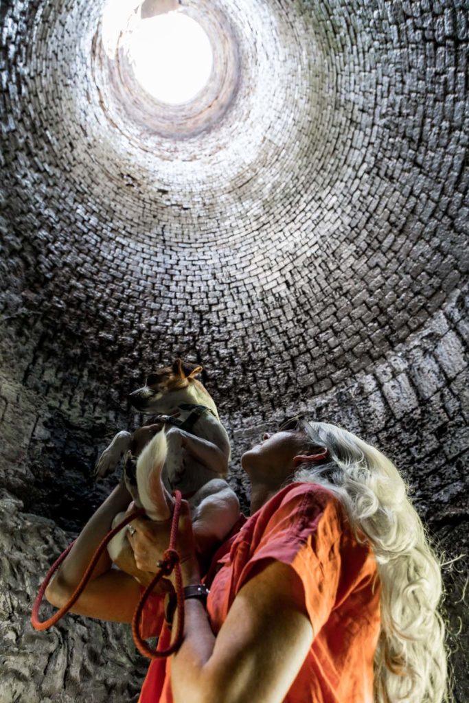
Continuing north a few miles, we follow Route 11 and then Katahdin Iron Works Road and eventually park beside a meadow of bright green grass. I see monarch butterflies fluttering at the edges. There’s a staffed gatehouse and signs that point to a state historic site, remnants of the defunct Katahdin Iron Works that are rising in the distance a few hundred yards out. Made of stone, the structure reminds me of a castle turret, and was part of the furnace used in the mid- to late-1800s to smelt iron ore mined from nearby Ore Mountain.
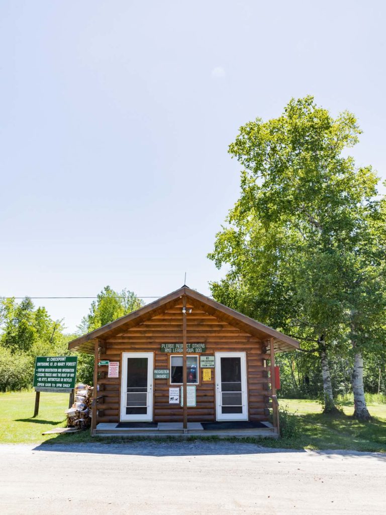
To drive onward to the Gulf Hagas trailhead, we need to register at the gatehouse. There are maps inside, and the attendant tells us it’s a busy day, with about 40 cars having already checked in, “and there might be three or four people in each car, so that’s a lot,” she says.
On the logging roads, clouds of white dust bloom behind passing trucks or cars. When all’s clear, the level of roadside natural beauty is high. We pass ponds, views of distant mountains, and riverside campsites (most full) along our way to the trailhead parking area, which looks to be where many of those 40 cars have parked.
Soon, we’re walking on a stretch of the Appalachian Trail in the shade of the Hermitage, an old-growth stand of white pines that, like Gulf Hagas itself, is a National Natural Landmark. In a region where timbering is a primary industry, being among 35 acres of 150-year-old protected trees feels especially important, and cathedral-like.
When there’s a break in the tree cover, we see and hear the water of Gulf Hagas Brook. The trail continues on the opposite shore, and several people on both sides are sitting on benches taking off or putting back on their shoes. The brook spans about 150 feet from bank to bank, and some hikers are calf-deep in the water picking their way across. I notice that some are barefoot, and I put my shoes in my backpack and go that way too, but it’s a slippery crossing. Dogs are permitted on the trail, and we have our hound-terrier mix along. With her leash in my hand, we ford the brook together, navigating the round boulders and smaller stones in the chilly water.
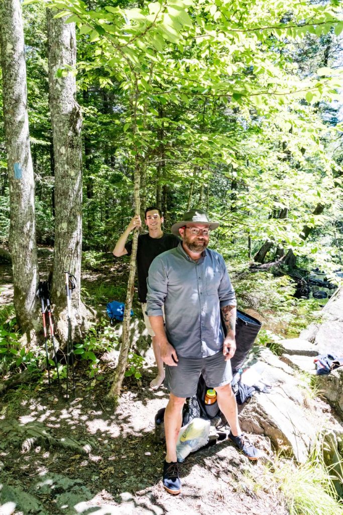
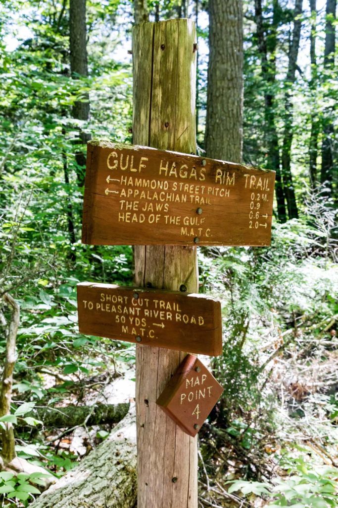
At a bend in the brook farther on, we come upon several AT hikers who have arranged their socks to dry out in the sunshine on warm rocks. They look like they just had a dip in one of the clear pools. The woman and two men tell us they’ve just completed the 100-Mile Wilderness section of the trail, which begins in Georgia and ends on Mount Katahdin. We’re the first non-AT hikers they’ve seen in days, and they introduce themselves with their trail names: “Trial by Fire,” “Beast,” and “Tropic Thunder.” After talking a bit, we hike on, noting that white blazes of paint on the trees show where the AT continues, and the blue blazes mark the Gulf Hagas Rim Trail.
Still following the brook, it’s slow going on the narrow trail; you need to watch your footfalls and be mindful of the vertical drop toward the water. Often, the brook is obscured by trees, but when we reach Screw Auger Falls, there’s a natural overlook above. Water pours in a white veil for a 15-foot drop into a punch-bowl pool below. From our viewpoint on the trail, I hear a splash then see a man pull himself out from the deep pool and then stand on the rock rim, dripping, to ready himself for another cannonball jump into the water. He repeats this several times while a woman and young girl stand nearby, clapping.
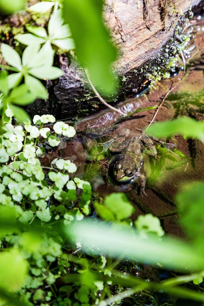
We strike out for more views of the brook and then the West Branch of the Pleasant River, where the gorge deepens. Passing fewer hikers now, we see a fat toad resting, then chipmunks and squirrels darting past. In a sunny opening above gorge walls that drop 100 feet in places to the river bottom, we find ripe blueberries ready for picking and have a trail-side snack. So, this is Gulf Hagas. After a couple of hours, we make our return via one of the shortcut paths to the Pleasant River Tote Trail, which is a wider, less rocky route to the parking lot that includes a crossing again of the brook, this time with my shoes on.
From The West
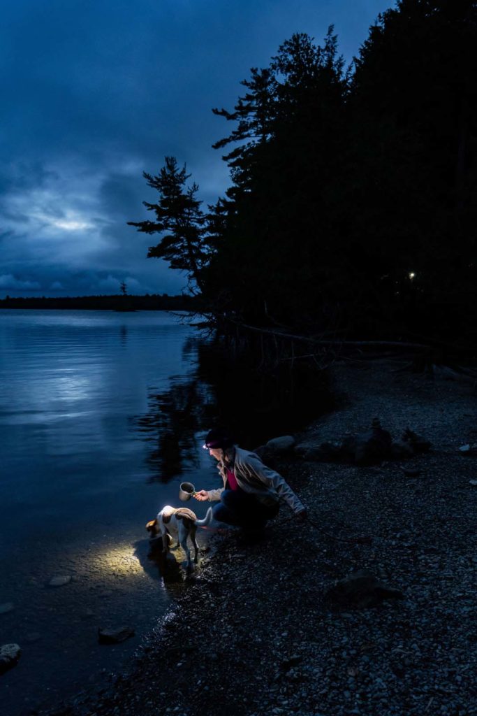
In mid-September, we drive north again for another venture into Gulf Hagas. We completed only about half of the route in our summer daytrip, and this time we are driving to Greenville to set up camp for an overnight so we can get an earlier start. The plan is to hike from Head of the Gulf trailhead on the western end. A night of tenting beside Moosehead Lake, another grand water feature, will add to the adventure. Lily Bay State Park has wooded sites ringing the shores of the lake, and with most of the sites open when we arrive, we claim one that overlooks a cove with a sandy beach. A pair of ducks waddle the strand at sunset.
With firewood bought at the camp entrance while two deer munched grass a few yards away, unfazed, we make a campfire to sit by for a while before we settle into our sleeping bags.
In the morning, we pack up and head into Greenville, where we find Auntie M’s open, so we stop for a hot breakfast of pancakes and maple syrup. The busy diner will make to-go brown bag lunches for hikers and hunters, and we order chicken salad and egg salad sandwiches to take on the trail—each comes with an apple, chips, and a cookie. We have our water bottles filled and are ready to hike when we drive on for about a dozen miles, following Pleasant Street, which becomes the Katahdin Iron Works Road.
There’s also a cabin-style gatehouse at this end. “Most people come in from the other side,” the gatekeeper at the Hedgehog checkpoint tells us. For entry, the fees are the same as before—cash or check of $14 for out-of-state visitors, $9 for residents. We drive on a few miles to a parking area that’s nearly empty.
The trail here is wetter. Split-log bridges help in the boggier areas, and we see the hoofprints of moose in the mud. Mushrooms and ferns are flourishing along this trail. We continue through the woods to a bridge over a tributary of the West Branch of the Pleasant River, just before the first Gulf Hagas trailhead signs. That’s when we discover something fascinating. In the soft dirt is a hole at least a foot deep with the spent shells of turtle eggs strewn about, and we see motion. A snapping turtle that’s no bigger than a half-dollar coin is squirming among the shells. It looks so small in this vast forest. I carry the tiny creature to the edge of a river pool around some sheltering rocks in hopes that it will find its way.
Then it’s onward for us for about two miles. The trail narrows, and we pass moss-covered boulders and step on thick tree roots that weave across the trail. Eventually we hear rushing water and follow side pathways to a series of rock outcroppings, one giving a wide view of the Stair Falls in three directions. I am satisfied that this is the pinnacle of our excursion and sit awhile to watch, pulling out the sandwich lunches. But after we eat, we find there’s more. We scramble up rises in the trail until we are on a cliff’s edge. At Head of Gulf and at gushing Billings Falls, the view is dramatic, truly a canyon. Far below, the water tumbles past, naturally.
Perched on a rock with our dog again at my side, I feel lucky. So far from any of the noise of modern life, we’re here simply to witness the force of water. Below us, this Pleasant River is perpetually cascading deeper through the tumult of ancient rock. On this circuit of Gulf Hagas trails—from either direction—the natural wonders make for a destination that doesn’t have the size, infrastructure, or recognition of Acadia. You have to know to go. And, for us, it’s just those lesser-known qualities and surprises that make the Gulf Hagas adventure special.
Gulf Hagas Exploring
Open for hiking May to October, the remote, looping trails around Gulf Hagas offer moderate-to-difficult hikes of 4 to 10 miles. Details about the trail locations, maps, current visitor fees, and other information can be found at northmainewoods.org.
Lodging Options:
Lily Bay State Park
Greenville
maine.gov/lilybay 207.695.2700
AMC Little Lyford Lodge + Cabins
Greenville
outdoors.org 207.280.0708
KI Jo-Mary Campsites, North Maine Woods, Inc.
northmainewoods.org 207.435.6213
Land Camping
Brownville
landcampground.com 207.965.8400